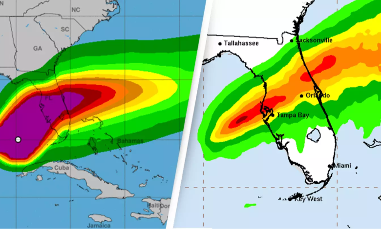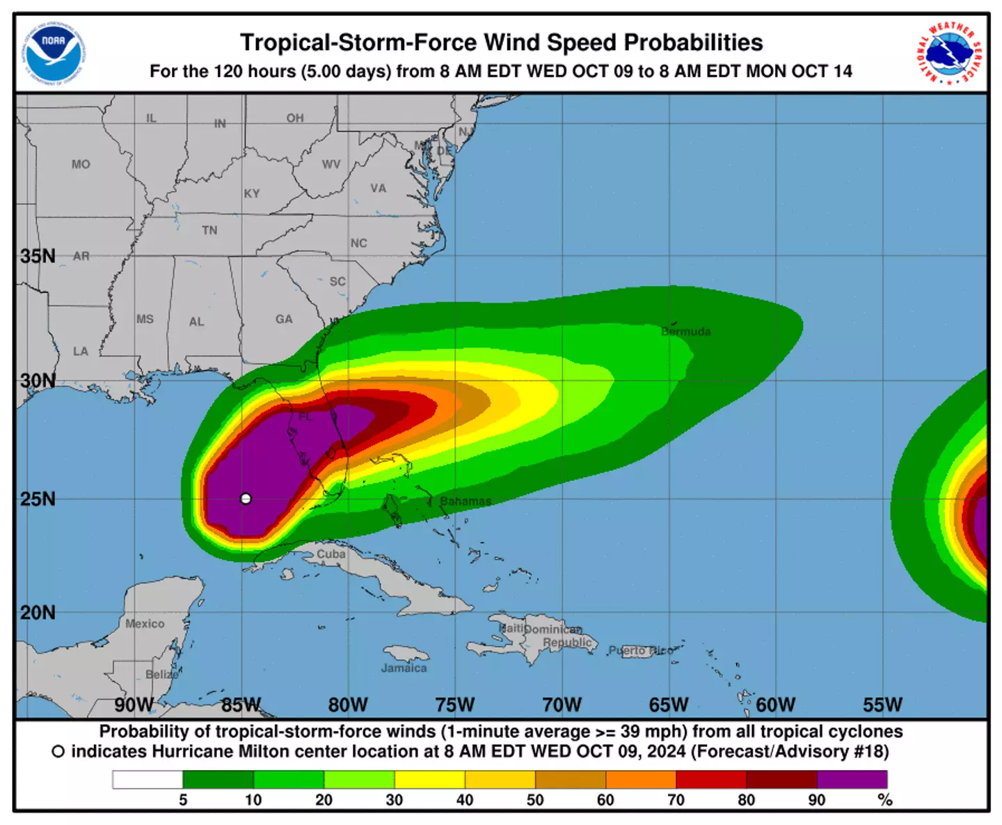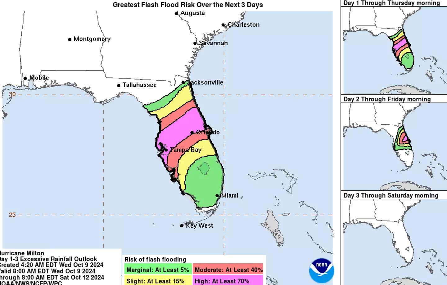
Although Hurricane Milton’s point of landfall is still unknown, a slight shift in its track could mean catastrophe for the Tampa area.
Declared a Category 4 storm on Wednesday, Milton is currently barreling toward the Florida Peninsula and is forecasted to make landfall overnight.
The National Hurricane Center previously described Milton as ‘extremely life-threatening’ and warned that most of its devastating impact will likely occur in the Tampa Bay Area.
Home to about three-and-a-half million people, the Tampa Bay Area is currently the most vulnerable metro area to storm surge, with forecasts indicating that Milton will likely push 8 to 12 feet of seawater onto shore based on its current track.
While storm surges are expected, exactly how much will depend on where Milton hits. Per USA Today, if Milton arrives south of Tampa Bay, a ‘reverse’ storm surge could suck its bay dry. However, if it arrives 10 to 20 miles up north, a storm surge will likely overwhelm the area.
Rick Davis, a meteorologist with the National Weather Service in Tampa Bay, told USA Today that Milton’s path is difficult to predict and a margin of error of about 25 miles will still exist 12 hours ahead of landfall which could make a ‘big difference.’

“That is going to be a big difference on storm surge conditions in the Tampa Bay area,” Davis explained. “If it just moves another 10 or 20 miles, then all that surge will be materialized in Tampa Bay.”
Davis also added that the winds guiding Milton are highly influenced by shifts in the jet stream explaining, “Any little ripple in the jet stream can push the storm in one direction or lift it in another direction. So it’s very chaotic.”
The National Hurricane Center urged people ‘not to focus on the exact landfall point’ earlier today, emphasizing that ‘Milton’s exact landfall location is not possible to predict even at this time, particularly if the hurricane wobbles during the day and into this evening.’

Weather is difficult to predict in general and those circumstances are exacerbated when it comes to hurricanes. Milton’s point of landfall has bounced north and south within the past 24 hours alone and is likely to continue to do so.
“It’s weather. It’s chaos. There’s inherently uncertainty in the weather,” Davis noted.
Although the exact point of Milton’s landfall and the magnitude of its storm surges are still to be precisely determined, the National Hurricane Center said: “The risk of devastating storm surge still exists across much of the west-central and southwest coast of Florida given the size of the storm and the uncertainties in exactly where landfall will occur.”
Source: unilad.com


